Explosive Ordnance Investigation using DTM
Project details
Explosive Ordnance Investigation using DTM
Order
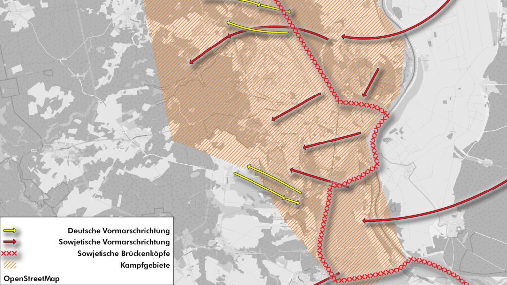
- Explosive ordnance risk assessment through combined source and aerial photo evaluation.
- Basis: Analysis of 13 aerial photographs, digital terrain model (DTM), in-depth historical research (especially Red Army documents from the Central Archive of the Ministry of Defense of the Russian Federation (CAMO).
Area size
- 28 km train path.
Results
- On 44% of the route, there is a risk of encountering unexploded bombs. Here, one must also expect to find blind shells as well as hand-held ordnance and ammunition that have been left behind or buried.
- According to the construction guidelines for explosive ordnance disposal, there is a need for further investigation in the designated areas (category 2). To clarify the further procedure, we recommend consulting the responsible explosive ordnance disposal service, a specialist planner for explosive ordnance clearance or a specialist company for explosive ordnance disposal. The latter must be licensed in accordance with Section 7 of the Explosives Act (SprengG) and have the appropriate personnel with a certificate of competence in accordance with Section 20 of the Explosives Act (SprengG).
- No further action is required for the remaining route sections (category 1).
Luftbilddatenbank Dr. Carls GmbH | Sieboldstraße 10 | D-97230 Estenfeld | +49 (0) 9305 90 00 20 | Privacy Policy | Imprint | Contact