Explosive ordnance investigation with height reconstruction
project details
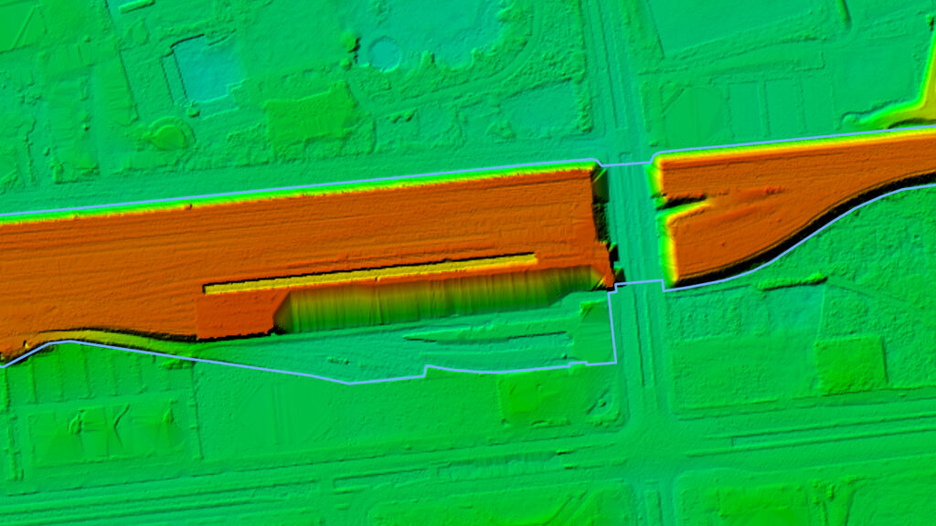
Height Reconstruction
Order
- Explosive ordnance risk assessment through combined source and aerial photo analysis.
- Basis: Evaluation of 120 aerial photographs from several time periods, evaluation of a DTM, historical research according to our standards, mapping of terrain changes in the post-war period.
Area size
- 20 hectares.
Results
- Approximately 97% of the project area is at risk of encountering unexploded bombs (blast bombs: 250-8,000 lb caliber, incendiary bombs: 4-250 lb caliber, assigned to the respective attacks), possibly with long-life fuses (air raid causation scenario).
- Less than 1% of the project area has potential exposure to abandoned or disposed ordnance (munitions destruction causation scenario).
- No evidence of ground fighting was observed in the project area.
- According to the construction guidelines for explosive ordnance disposal, there is a need for further investigation (category 2) for the designated areas. We recommend consulting a specialist planner for explosive ordnance disposal.
- Between the 1950s and today, some areas of the project area were filled. They have thicknesses between 4 and 5 m. The extents were shown in the results map.
Luftbilddatenbank Dr. Carls GmbH | Sieboldstraße 10 | D-97230 Estenfeld | +49 (0) 9305 90 00 20 | Privacy Policy | Imprint | Contact